THE HEIGHTMARK GUIDE
How to save your elevation on iPhone without tracking the whole hike
Heightmark is an altimeter that remembers. Open it where you stand, read the elevation supplied by iPhone Location Services, and tap once to save that place as a mark. There is no start button, no GPS trail, no elevation gain, and no workout log. It works the same at a mountain pass, a city viewpoint, or a train window.
Step by step
Read the elevation where you stand
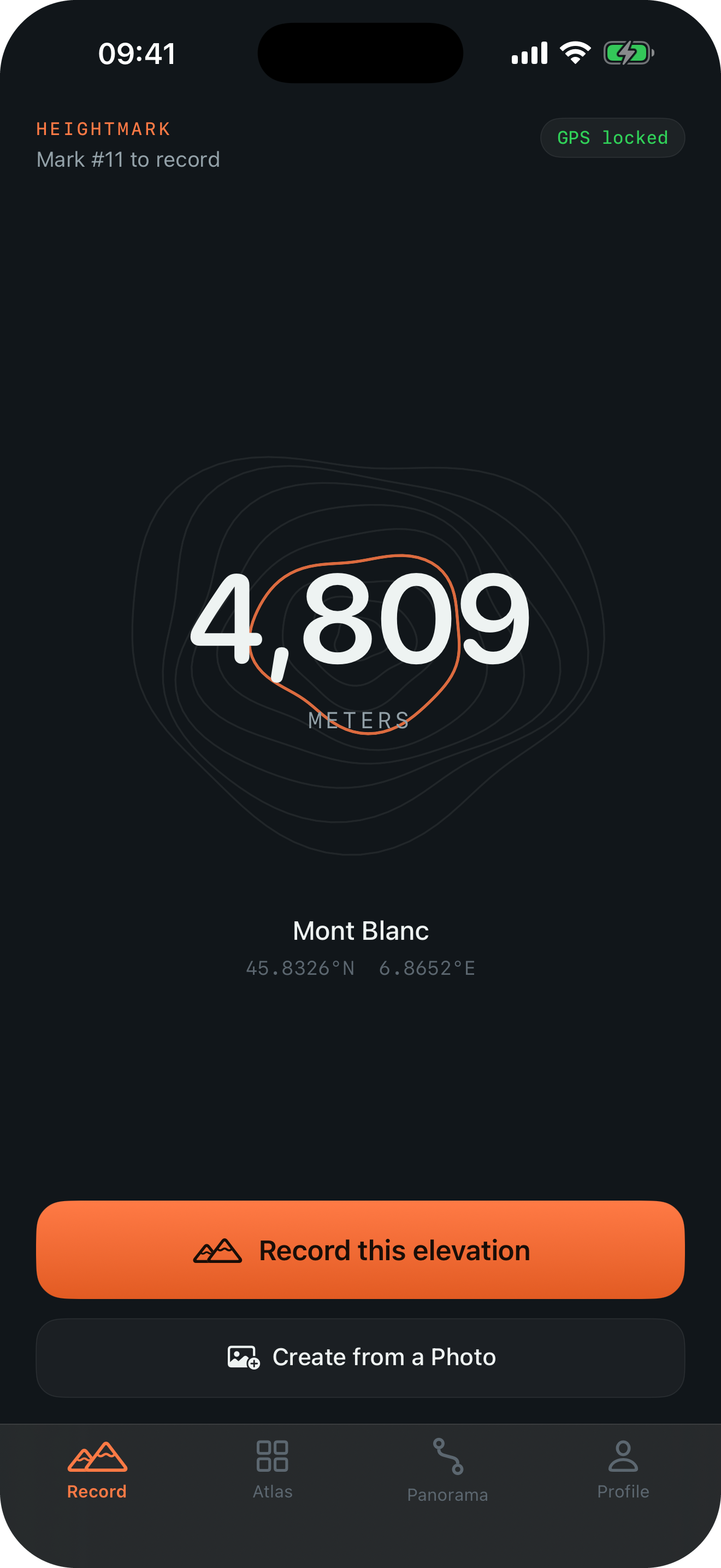
Open Record. Allow location access and Heightmark shows the current elevation, the coordinates, and the vertical-accuracy estimate from iPhone Location Services. You can stop here if a reading is all you wanted.
Tap once to save the place
Tap “Record this elevation”. The mark keeps the elevation, coordinates, place name, and time. Nothing was recorded before the tap, and nothing is recorded after it.
Add a photo or a note if you like
Both are optional. A mark with no photo is still a complete record of “I was here, at this height, on this day”.
Come back to it later
Your marks sort by elevation or date in your atlas, and line up beside world landmarks in the Panorama. Meters and feet are available in Settings.
What Heightmark records, and what it does not
Route-tracking apps such as Strava, AllTrails, or Gaia GPS record a continuous track from start to finish. Heightmark records one point at a time, only when you ask.
| You want to keep | Heightmark | Route-tracking apps |
|---|---|---|
| The elevation of a place you stood | Yes, one tap | Yes, inside a recorded activity |
| A GPS trail of the whole hike | No | Yes |
| Accumulated elevation gain | No | Yes |
| Pace, distance, workout statistics | No | Yes |
| A city stop, a road pass, a lookout reached by car | Yes, the same one tap | Usually needs an activity to be running |
| Location use between marks | None; nothing runs in the background | Continuous while recording |
Is Heightmark a live altimeter?
On the Record tab, yes: it shows the current elevation and accuracy estimate while you stand there, and you can watch it settle before you save. It is not a background altimeter. It does not keep reading while the app is closed, and it never turns a day into a track.
Who saves places this way?
Travelers who cross a high pass by train or car. City walkers who want to remember a rooftop or a lookout. Hikers who only care about the summit, not the approach. Anyone who wants an elevation journal without opening a fitness app.
Start your elevation journal
Recording is free. Up to 10 marks can be in your Atlas; additional marks remain saved in Not in Atlas. Optional, one-time Heightmark Pro adds every mark to your Atlas and Panorama and unlocks premium sharing templates.
Download on the App Store